Reconstruction Methodology
The computer models of Portus produced prior to the start of the AHRC Portus Project were based upon the interpretation of standing structural remains uncovered by successive archaeologists, particularly Lanciani (1868), Lugli (Lugli & Filibeck 1935) and Testaguzza (1970) as well as more recent topographic work undertaken by the Soprintendenza di Beni Archeologici di Ostia, and most the survey work undertaken by the Universities of Southampton and Cambridge in association with the British School at Rome. More recently this work has been superseded by the CGI work carried out alongside the basis of additional survey, 3D geophysics, and excavation.

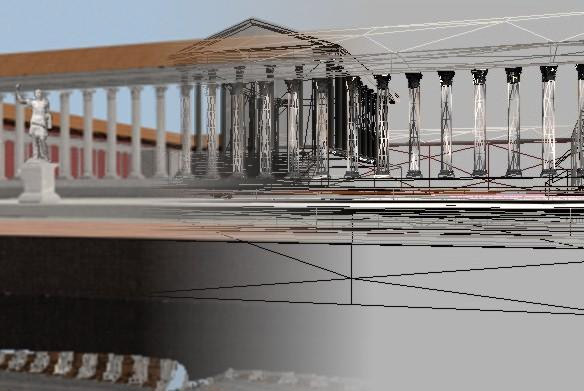
By using high-end computer graphics software and the interpretative plans created from the recent geophysical and topographical data, a scale model of each significant stage in the history of Portus was constructed using simple 3D objects. Basic texture maps were added to create impressions, such as that each warehouse had multiple openings.
One of the most challenging problems encountered in creating a VR model of Portus was that despite the previous archaeological work, our understanding of the appearance of many buildings is still far from comprehensive. Most buildings, such as the temple and temenos and the Foro Olitorio, are only known in ground plan, and which can only be reconstructed in generic terms by looking at the standing remains of buildings elsewhere. Those structures which are still standing, such as the Grandi Magazzini di Settimio Severo, have been heavily restored. Furthermore the layout and character of some buildings, such as the “Palazzo Imperiale“, many of the horrea and the Portico di Claudio are unusual with no known parallels outside Portus. In other areas, such as the area between the Port of Trajan and the Tiber, the geophysical survey has provided us with evidence for buildings whose character is unclear, even though the abundant presence of pottery, glass and marble on the surface suggest that commerce was an important activity here. Finally, although the recent survey work means that we now have a far more complete plan of Portus than before, there are still many gaps in our knowledge, giving the possibly mistaken impression that the port was less intensely occupied than one might have expected. There are several areas around the Trajanic Hexagon and between it and the “Fossa Traiana” where access was not possible, or where geophysical results lacked clarity.
