Aerial Photogrammetry at Portus
In the previous post by Stephen Kay on Unmanned Aerial Vehicles at Portus he discussed the work that has been completed on site in terms of capturing aerial photography. Aerial photography plays a significant part within the understanding of any archaeological site and this is especially true at Portus. As Stephen says it provides the ability for the archaeologist to have a bird’s-eye view of an excavation and it gives them the opportunity to see the plan of structures, their relationships with each other and alignments which are not visible at ground level. These images are however still a static representations of the area of interest, represented through 2D views. Part of the work that I have completed for the Portus Project incorporates these static images to produce 3D reconstruction through photogrammetry.
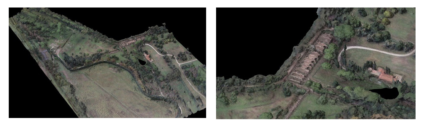
For the first time in 2013, Portus utilised UAVs in the documentation of these aerial photographs having previously used balloons, elevation cranes and a local police helicopter. The introduction of these UAVs has allowed the team at Portus to control the documentation of the site in more ways than was previously possible. The UAVs that were used at the end of field school allowed for a full control over how the images were taken. We could focus on specific areas for longer, using the high resolution cameras that are used on site, as we were able to control the flight path of the UAVs. It allowed us to not only gather information from great heights but we could capture images from varying angles and height variations. This change in angle and distance is essential within the production of a photogrammetry model as the images need to contain enough pixel resolution and overlapping data to allow for the production of a 3D model. Previously having used balloons and cranes, the field of view gathered has been limited because there has not been enough room to manoeuvre the crane around the area of interest and the balloon system is affected too much by the change in wind. At Portus we were able to work closely with our Italian colleagues in producing the suitable images needed for the photogrammetry modelling and the results that will be shown highlight the potential that this methodology has within the understanding of the site.
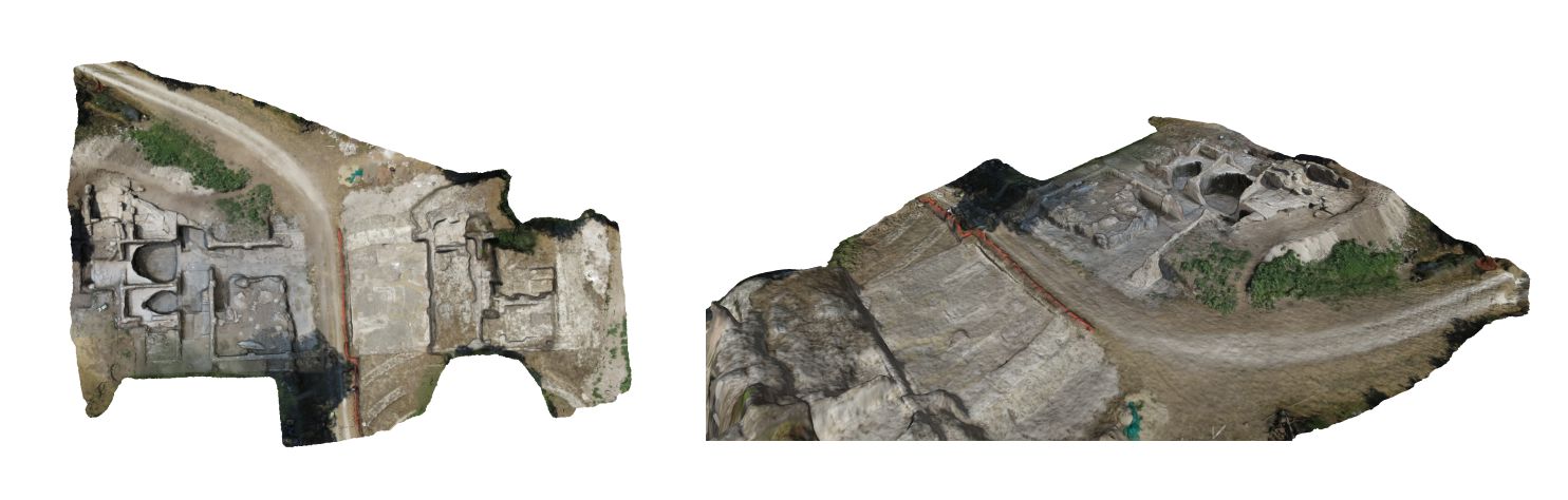
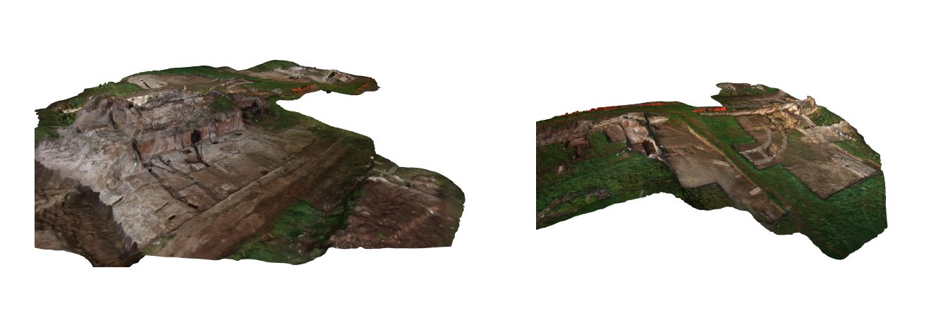
The datasets provided show unique views that archaeologists from the ground are unable to see. The Navalia excavation highlights the potential of recording the subtle details of the surface that are often missed when recorded with traditional methods. The datasets are not as good as the laser scan models produced because the models were produced explicitly from the aerial photographs. As this was a case study we wanted to examine how well photogrammetry could be utilised on site and in future the models that will be produced will combine these aerial photographs with photographs taken within a normal data capture. Laser scanning will always provide better results of large areas than photogrammetry does. This is due to the way in which both recording methods processes the data. In order to gain more comparable results there is a need to gather more photos at lower height variations, as there will be a great number of higher resolution images of the same area (instead of one image we could have twenty) allowing for a greater resolution model. Again our aim is to do this in the future.
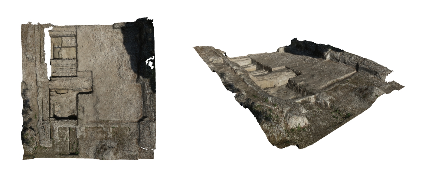
Having processed the photogrammetry models from 2013 there was a second recording session in early 2014. The same UAV was unable to be used and instead data was captured using a GoPro Hero black 3. This offers a lower resolution than the 36mpx camera used previously but the results that were produced are again very comparable. This was due to the way in which the data was captured. GoPros offer a greater lens distortion than normal cameras because of the fisheye lens that it uses and will affect the production of the photogrammetry model because of the changing pixel representation. As a result the camera was set on its medium resolution with the captured images providing a 7mpx resolution. A more focussed flight path was chosen to allow for a series of close up images that incorporated the necessary overlap needed. In total several thousand images were collected. Each of these were processed to remove the lens distortion and cropped to remove any erroneous data that were inherent within the images (due to the removal of the lens distortion). The best images were then chosen and a number of models were produced.
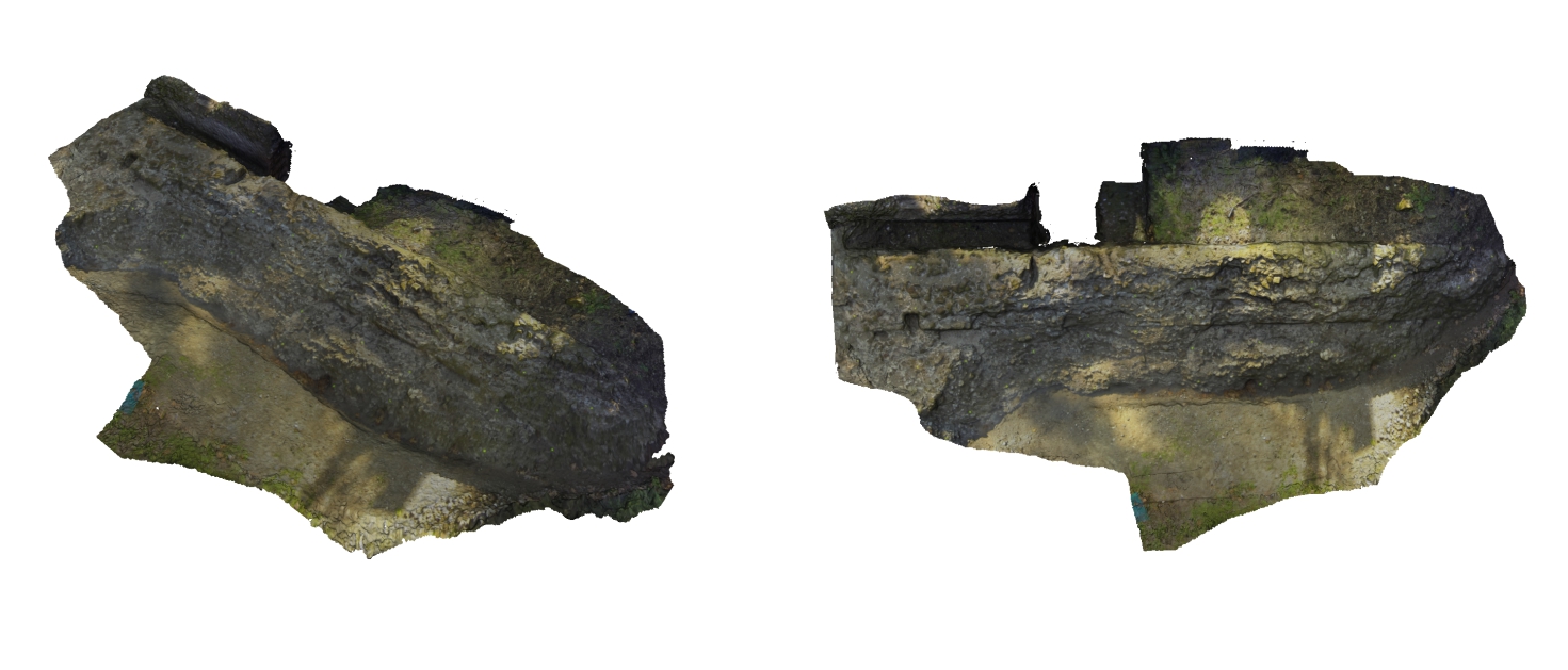
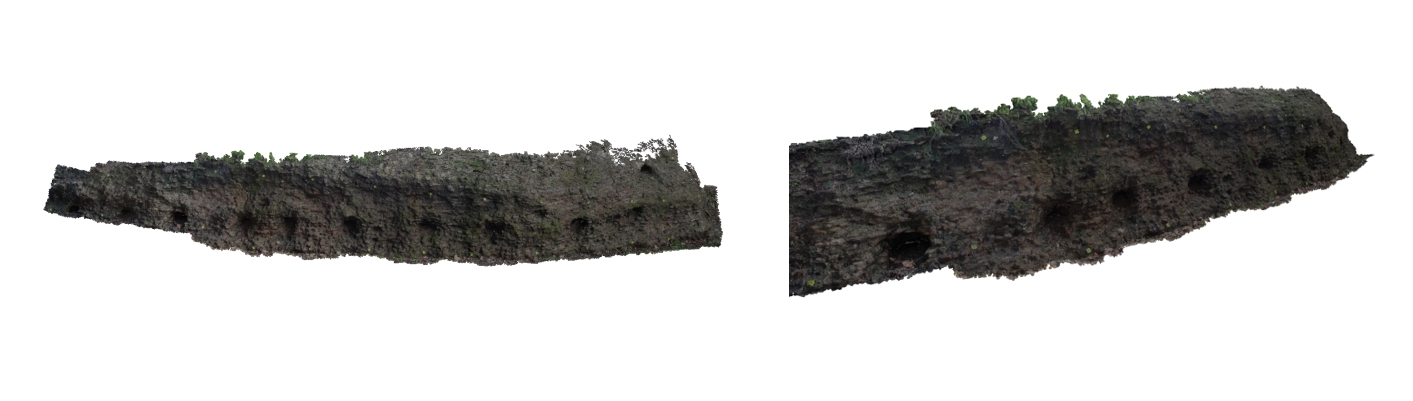
Having processed this data my attention then turned to the archive that the Portus project has. There are over 30,000 images that have been taken around the site documenting its changing pattern. The images were never intended to be used within the production of 3D models but rather as a way to simply record the site year by year. I have personally posted a review of AGIsoft Photoscan here and the great thing about the software that we use to process our models, is that it will try and produce a virtual model regardless of the images that are inputted. As a trial method I used the images that Professor Simon Keay captured in 2009 from the police helicopter and I successfully managed to produce a high resolution model of the entire site. I have since produced a number of other models based on our archive and I will slowly make my way through to see what else I can produce. Although the results are missing some data because of gaps of information, the main thing that this offers is that not only are we using our archived images but we are now able to virtually document the changing pattern of the site since the excavation at Portus began. This offers further research avenues that can be incorporated into the future digital recording that will take place over the next few years.

A video from the on board GoPro camera used on the dji Inovations drone highlighting the field of view, stability and flight path of the UAV.
A video of the dji Inovations S800 spreading wings drone taking off and landing. Notice the stability provided by the multiple propellers