Sidescan Sonar
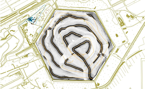
A side scan sonar survey was undertaken of the hexagonal basin at Portus. Side scan sonar imagery is the equivalent of a high resolution geo-rectified aerial photograph but uses sound rather than light as an imaging source. It provides us with an underwater picture of the submerged harbour bed. Through a combination of slow survey speeds, co-registered DGPS navigational information and high pulse rates we were able to grid the complete data set in the form of a mosaic at a 6 cm bin size; this enabled us to be confident in identifying targets exposed on a harbour bed with a minimum size of c. 20 cm. The side scan sonar data has been processed and brought into a computerized mapping programme (ArcGIS) and then merged with the overall plans of the harbour created by the main Portus project. The survey identified a total of 135 sonar anomalies which are spread around the margins of the harbour basin, the majority of targets being within 125 m of the basin walls. There is no obvious pattern to the targets other than a distinct lack of targets (only 3) along the southern margin of the lake. Targets vary in size from c. 0.5 m to 5.8 m in size with the majority of targets being between 1 and 2 m in dimension. It is anticipated that a dive team will be deployed in the near future to establish the archaeological potential of these anomalies.

