Sub-Bottom Profiling
Whereas the sonar system produces an image of the current harbour bed, our sub-bottom profiling system (a ‘Chirp’ system) produces two-dimensional slices through the harbour bed. The resulting imagery is similar to the Ground Penetrating Radar imagery that has been produced by the project. A broad grid survey framework was deployed in order for us to provide an overview of the harbour from this first survey: using a simple survey strategy of lines run between corners of the hexagon and along each side. The Chirp system has been modified at the University of Southampton, to produce optimal resolution data (c. 10 cm vertical resolution) of the top 10-20m of sediment depending on sediment type and water depth. Earlier information about the hexagonal basin suggested that we had relatively fine-grained sediments and water depths that reached a maximum of c. 8 m in the centre of the basin – ideal conditions for Chirp imagery. In reality we identified from the side scan sonar survey that the water within the basin is much shallower than we had thought, with a maximum and consistent water depth of only c. 3.25 m. Consequently, penetration of the harbour bed was limited and the high energies inputted into such a shallow water column resulted in relatively degraded traces. What can be established from this data is that the sediments within the basin are very homogeneous both spatially and vertically. No major targets were identified.
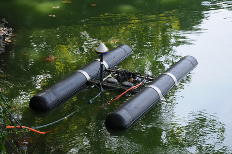
Photo: Hembo Pagi / ACRG