Topography
The Site and the Portus Project
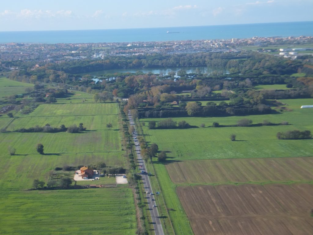
Looking westwards towards Portus. Photo: Simon Keay
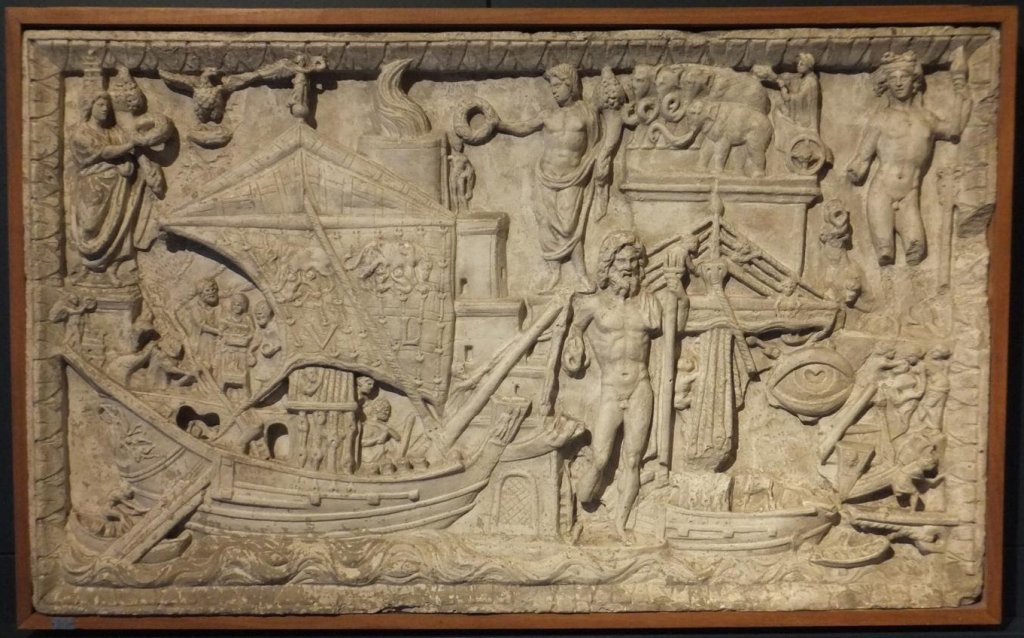
Portus was the maritime port of Imperial Rome, and for c. 500 years was the commercial hub that connected the Metropolis to the broader Mediterranean. It was a very large complex covering c. 5.2km2 and which encompassed c. 230.5 Ha of harbour basins and quays, as well as canals, warehouses, temples, churches, houses and administrative buildings. Since it is also one of the best preserved Roman Mediterranean port sites and now lies inland, it can be readily studied to learn about how it was organized and worked, the richness and volume of traffic and cargoes that passed through it, and the range of its contacts across the Mediterranean. It also presents us with considerable challenges, however, not least in terms of the very large scale of the complex and its buildings, but also in the sheer volume of the finds.
Following the completion of a geophysical survey of Portus between 1998-2004, our more recent research at the site has consisted of two inter-related AHRC-funded initiatives, the Portus Project (2007-2011) and the Portus in the Roman Mediterranean Project (2011-2012). Both of these involved the University of Southampton, the British School at Rome, the Soprintendenza Speciale per i Beni Archeologici di Roma, and the University of Cambridge, as well as a range of other partners in the UK and Europe. In the project, we adopted an inter-disciplinary approach to the study of Portus, with techniques ranging from field archaeology to computing, the physical anthropology and biological profiling of human skeletons, geo-archaeology and environmental analysis. The training of students in many of these and other techniques were a key feature of the projects. In more recent years, fieldwork has continued with the Portus Fieldschool (2013-2015, 2018), by means of the ERC Advanced Grant funded Rome’s Mediterranean Ports (PortusLimen) project (2017-2019) and the University of Southampton and the Loeb Foundation (2020 and 2021).
Focus of Research
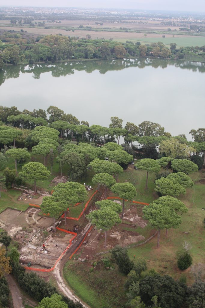
Development of the Central Isthmus

We have traced the structural history of Portus, from its establishment under Claudius, to its enlargement under Trajan and subsequent emperors down into the 4th c AD. Five key buildings on the central isthmus of the port played distinctive roles in respect to the Claudian and Trajanic harbour basins and a related canal. By c. AD 120, the three-storey Palazzo Imperiale (Buildings 1, 2, 3 and 8) was established as an imperial maritime villa, with administrative functions; a small amphitheatre was added in the early 3rd c AD; the adjacent Building 5 may have initially been an imperial navalia, or imperial arsenal; the Grandi Magazzini di Settimio Severo was built at a date in the later 2nd c AD, probably for the administrative control of cargoes moving through the port.
Decline of the Central Isthmus

The later 5th and the 6th c AD witnessed the gradual siltation of the outer Claudian basin, a contraction in the extent of the port, a transformation of the function of its buildings and in the volume and range of its traffic and cargo. In the 450s, the five buildings under study were enclosed within a defensive wall designed to protect the inner Trajanic basin from seaborne attack, possibly from Vandal pirates. Buildings 5 and 3 were systematically demolished in the mid to later 6th c, probably by the Byzantine authorities, and burials began to proliferate amongst the ruins.
Relationship between Portus and Ostia
The large scale and complexity of the port infrastructure at Portus is best appreciated by remembering that by the early 2nd c AD it was the central node in what might term as a “port-system”. Communication between Portus and Ostia and the commercial district of Rome, was articulated by a network of canals and the river Tiber itself. Our work has greatly increased understanding of a key part of this, the Isola Sacra, that lies between Portus and Ostia. It has revealed a massive new canal running south from the Fossa Traiana and parallel to the cemetery, field divisions, and warehouse complexes.
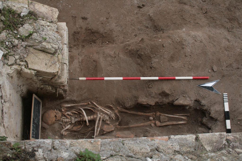
Everyday Life at the Port
Although people were central to the life of any port, there is very little archaeological evidence for the inhabitants of Portus, or indeed many Roman Mediterranean ports, aside from occasional tombstones. Anthropological analyses of c. 43 inhumation burials of c. 6th c AD date from our excavations point to a predominantly male population involved in heavy physical labour with a heavy carbohydrate diet – a finding borne out from analyses of 3rd c AD burials nearby (La Tenuta del Duca). Recently published oxygen isotope evidence has investigating the origins of these people, as well as their foodstuffs. An idea of their cultural practices is coming from the table-wares and kitchen wares that they used, as well as from chance finds of rings and other personal possessions.
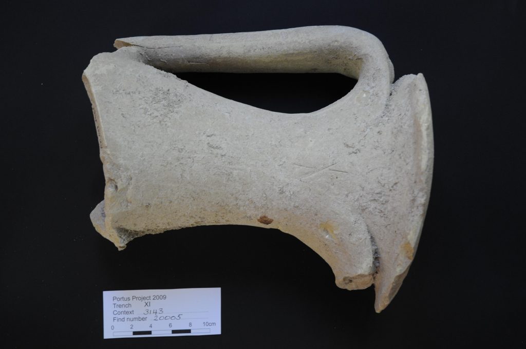
Commercial Activity
Portus’ primary role was to supply the 800,000 inhabitants of Rome with foodstuffs and the other materials, as part of the annona. It was also a hub for re-distributing imports from other Mediterranean ports and, to a lesser extent, exporting construction material and other products from the Tiber valley. Analyses of amphorae, table and cooking wares, bricks, decorative stone and carbonized seeds from our excavations has enabled us to trace changing commercial connections to known sources across the whole Mediterranean basin, underlining the particular importance of north Africa (ceramics) and the east Mediterranean (decorative stone). Our work has also revealed the presence of Italian products ceramics, either for use in the port or for export.
Videos
The following three videos provide footage showing: the Trajanic basin and a computer graphic reconstruction of Portus in the 2nd c AD (upper); an overview of the site of Portus (middle); early publications relating to Portus at the British School at Rome Library and general views of Portus (lower). The videos are reproduced with kind permission of Mallinson Sadler Productions. They were produced for the programme “The Rise of the Roman Empire�? in the National Geographic Series “Drain the Oceans�?. The reconstruction in it was based upon the Computer Graphic reconstructions of Portus by Grant Cox of Artas Media in conjunction with the Portus Project.