Towards a New Understanding of the Port of Claudius
Simon Keay, Steve Kay and Elena Pomar
The new programme of research in the Claudian harbour is focused on the central and eastern parts of the northern mole, estimated at least 1.7km in length. The previous campaigns between 2017-2019 to the west of Viale Coccia di Morto were successful in using Electrical Resistivity Tomography (ERT) and 3 targeted cores to provide additional detail to the data collected by the Soprintendenza in 2007-8.
In 2020 the extant remains of the northern mole in the area of Monte Arena were recorded by laser scanner. Using a Leica RTC360 scanner, a high resolution point cloud of the mole has been generated. The 3D model will allow a better understanding of the function of this section, its size, likely depth and phases of construction. This information will also be used to support the interpretation of the data from the other areas.
Further to the east, a campaign of ERT began in early February 2021 on Monte Giulio with the aim of recording the so-called Eastern mole of the Claudian harbour. The area was first investigated by Lugli in the 1930s, but the later excavations by Scrinari in the 1970s fully revealed a bath complex, ramp and large cistern. More recently (2007-2009), the Soprintendenza undertook a campaign of mechanical coring and deep trenches to better understand the artificial mound. The ERT survey will complete this research, surveying the area between the cistern and trenches to the south.
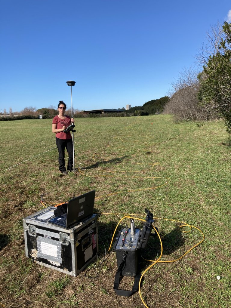
The start of the Loeb Foundation funded GPR survey of the Monte Giulio along the Claudian basin at Portus. 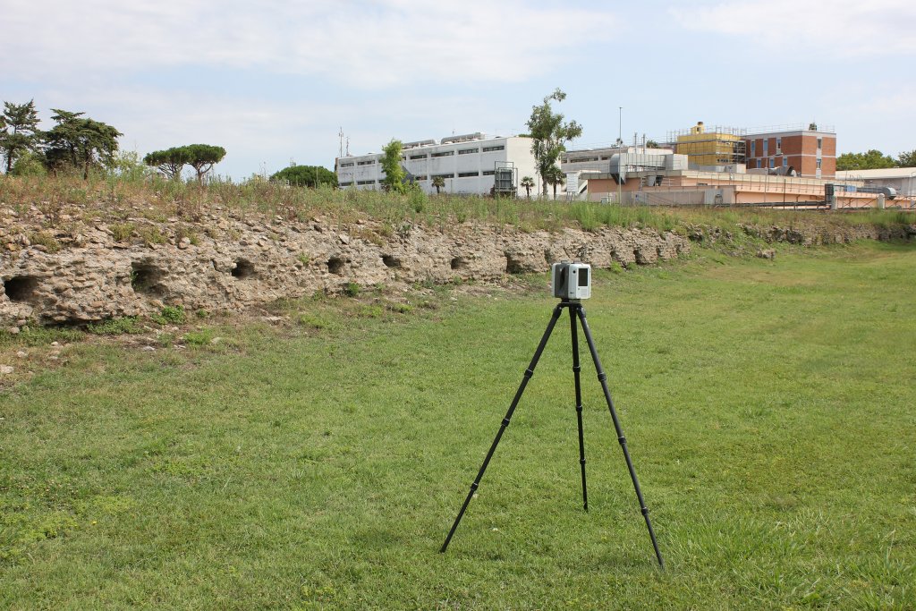
Preparation for the Loeb Foundation funded laserscan of the northern mole of the Claudian basin at Portus. 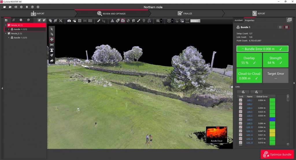
Laserscan of the northern mole of the Claudian basin at Portus.